
The layouts of early capital cities in China reflected how philosophy and social orders influenced urban planning in the ancient era. Planners considered the relationship between nature and humankind when zoning and planning traditional political centres. The early planning facilitated the knowledge of astrology and created counterparts of planets and stars on the earth to arrange the plans of capital cities. Recording a hierarchical model of cities, a classic writing-Kao Gong Ji (考工记) was later included in The Rites of Zhou (周礼) which is one of the most significant works of Confucianism, the grid urban model was then advocated and became the main planning method of capital cities in the following centuries.

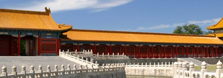
Figure 1 A painting of Forbidden City in the Ming Dynasty[1]
In the early planning of capital cities, the knowledge of astrology and constellations was used to imitate the appearance of heaven, in the light of the kings and emperors in ancient China were regarded to be the son of God. In this stage, a river which was considered as the counterpart of the Milky Way on earth usually went through the cities from west to east and took the royal residences on the northern bank and worship spaces in the south apart. According to The Records of the Grand Historian, the capital city of the first Chinese empire-Xianyang City of the Qin Dynasty (221-207 B.C.) was built based on this method modelling the heavens and the earth. Though this ancient approach was later replaced, its philosophy remained influential on traditional urban planning.
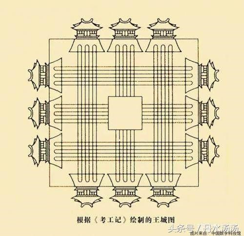
The introduction of an urban model in Kao Gong Ji (考工记) was a game changer in the early planning paradigm of capital cities. As a classic work of science and technology written between the fifth century B. C. and the third century B. C., Kao Gong Ji proposed a square urban layout based on the well-field system (井田制) which divided and ruled the land by a grid plan. The grid plan in Kao Gong Ji was different from the early planning method modelling the heavens and the earth, it regulated the standard of cities’ size, the locations and the number of city gates, streets’ width and urban zones following the imperial ritual system. Specifically, the ideal capital cities would be built on a square land with four 3742.2-meter edges, and each side of the city wall would be created with three city gates; A 9 by 9 grid would be used to divide and zone the land hierarchically for different purposes; streets would be about 16.632 meters in width; the south-facing royal palace would be placed at the centre of the city with an Ancestral Temple to its west and a Temple of Soil and Grain to its east; the south of royal palace would be a square where emperors met their administrative officers, while a market would be located to the north of the palace. The grid plan of capital cities and the well-field system demonstrated how the ancients understood nature and human society.

Figure 2 An illustration of the model of capital cities in Kao Gong Ji[2]
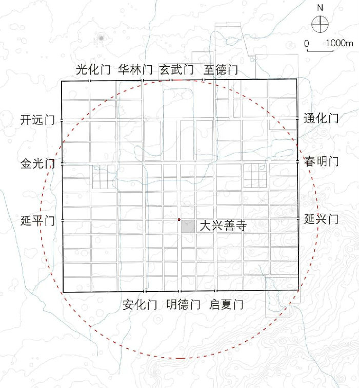
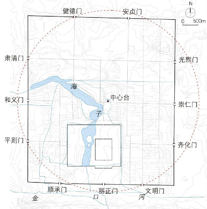
After the writing of Kao Gong Ji was included in The Rites of Zhou which is one of the most essential Confucian literature, the urban model was advocated by governors and scholars. The grid plan of towns thus was developed and used to manage the Confucian order in the following centuries and finally became the most typical approach of traditional urban planning in China, especial in those political centres. The Daxing (大兴城) of the Sui Dynasty (581-618 A.D.), Yuan Dadu (元大都) of the Yuan Dynasty (1271-1368 A.D.), and Ming Zhongdu (明中都) of the Ming Dynasty (1368-1644 A.D.) are proved to be examples of the planning practice.

Figure 3 A map of Daxing-the capital city of the Sui Dynasty[3]

Figure 4 A map of Yuan Dadu,the capital city of the Yuan Dynasty between 1267 and 1368[4]

Figure 5 A map of Ming Zhongdu, the capital city of the Ming Dynasty between 1369 and 1375[5]
Despite the grid plan was an ideal model for planning empires’ centres in ancient China, the construction of cities still needed to take the natural and geographic conditions of planned sites into consideration. This was perhaps why many traditional capital cities possessed their distinctive characters though they were planned in a similar manner, such as the old city of Nanjing.
[1] Source: National Museum of China
<http://www.wenbozaixian.com/portal/show_room/typecontent/id/14478/type/52/jclIndex/4>
[2] Source: <https://kknews.cc/history/8lq5re4.html>
[3] Source: <https://mp.weixin.qq.com/s/-oypP2YQfsP5ATrkB9RzkQ>
[4] Source: <https://mp.weixin.qq.com/s/-oypP2YQfsP5ATrkB9RzkQ>
[5] Source: <https://mp.weixin.qq.com/s/-oypP2YQfsP5ATrkB9RzkQ>
References:
<https://mp.weixin.qq.com/s/-oypP2YQfsP5ATrkB9RzkQ>
<https://mp.weixin.qq.com/s/JNUD15Y5vYBlj_N7KMUXLw>
<https://link.springer.com/article/10.1007/s11434-016-1188-6>
Edited and translated by Liang Xiuchun