

6. Chongqing Tongnan Fujiang Dafosi Wetland Park
The Chongqing Tongnan Fujiang Dafosi Wetland Park is situated on both banks of the Fujiang River, in the central area of Tongnan District. It serves as a green oasis on the riverside, adjacent to the scenic Dafosi area. With the aim of creating a "riverfront wetland that harmonizes with floods," the park preserves the natural tidal wetland environment, incorporates pedestrian corridors, and offers ample space for visitors to experience the wetland. Inspired by the rich cultural heritage of Tongnan, including its historical shipping culture and the influence of the Dafosi Buddhist temple, the park showcases a unique blend of local culture and provides a captivating urban riverside landscape.
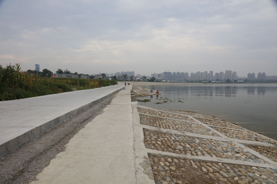
↑Before the ecological restoration
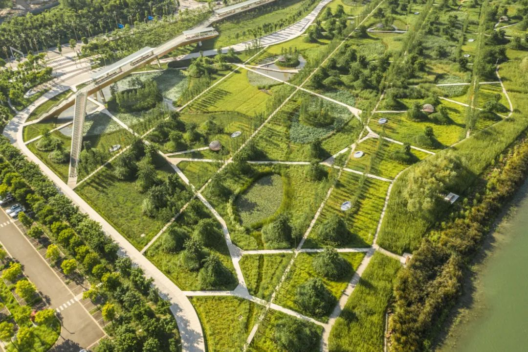
↑After the ecological restoration
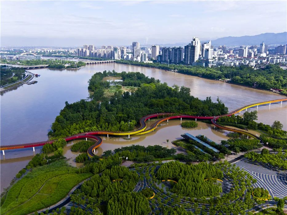
7. Jinhua Wuyi River Yanweizhou Park
The Yanweizhou Wetland Park in Jinhua embraces a harmonious coexistence with floods, promoting ecological resilience within the landscape. As the last remaining river floodplain habitat in downtown Jinhua, it serves as a sanctuary for diverse bird species and wildlife. The park's design is guided by flood-prone area analysis across different recurrence intervals, with a focus on preserving and restoring natural habitats to the fullest extent possible. By incorporating indigenous vegetation and leveraging the natural topography, an adaptable ecological flood control embankment is constructed to withstand recurring flood events. The park utilizes resilient native vegetation with strong adaptability as its foundation, adjusting plant configurations based on varying flood levels. This approach creates a diverse and dynamic landscape that effectively accommodates the natural processes of flooding.
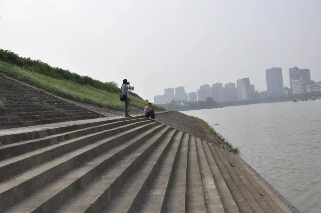
↑Before the ecological restoration
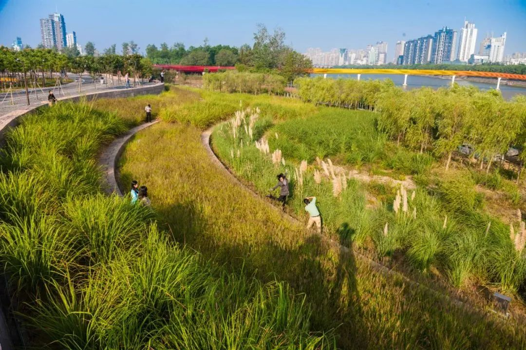
↑After the ecological restoration
8. Shanghai Expo Post-Exhibition Bund Park
In the Shanghai Expo Post-Exhibition Bund Park, an inner river artificial wetland zone is employed to ecologically purify the polluted water from the Huangpu River. The inner river wetland purification zone is designed to be 1.7 kilometers long and 5-30 meters wide, incorporating an enhanced artificial wetland purification technology. It is subdivided into various areas, including a gravel beach filtration zone, an integrated plant purification zone, a plant bed purification zone, a terraced field filtration purification zone, a heavy metal purification zone, a pathogen purification zone, a nutrient purification zone, and a water quality stabilization and regulation zone. As the river water from the Huangpu River enters the artificial wetland, it gradually infiltrates through the terraced field's varying height and the different plant heights, undergoing a layered filtration process, resulting in an improvement from Class V water quality to Class III water quality. The designed wetland water purification capacity is 2400 cubic meters per day.
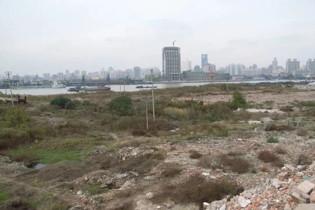
↑Before the ecological restoration
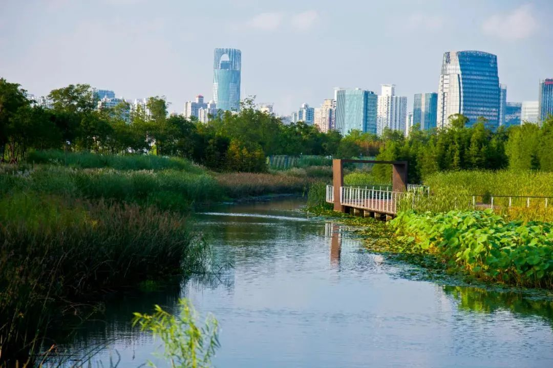
↑After the ecological restoration
9. Sanya River Mangrove Ecological Park
Sanya River Mangrove Ecological Park was established in 2016, covering a total area of 28 hectares. The concrete flood control walls constructed for urban development had previously suppressed the mangrove and river floodplain ecosystems. The design aimed to repurpose the existing landfill site, comprised of urban construction waste, and reshape the terrain into interconnected finger-like formations to introduce tidal influence into the park. Leveraging the height difference between the roads and water surfaces, an ecological corridor was established to purify surface runoff from the city. Within three years of completion, the project achieved the restoration of the mangrove habitat and fulfilled the goal of meeting the recreational needs of the citizens.
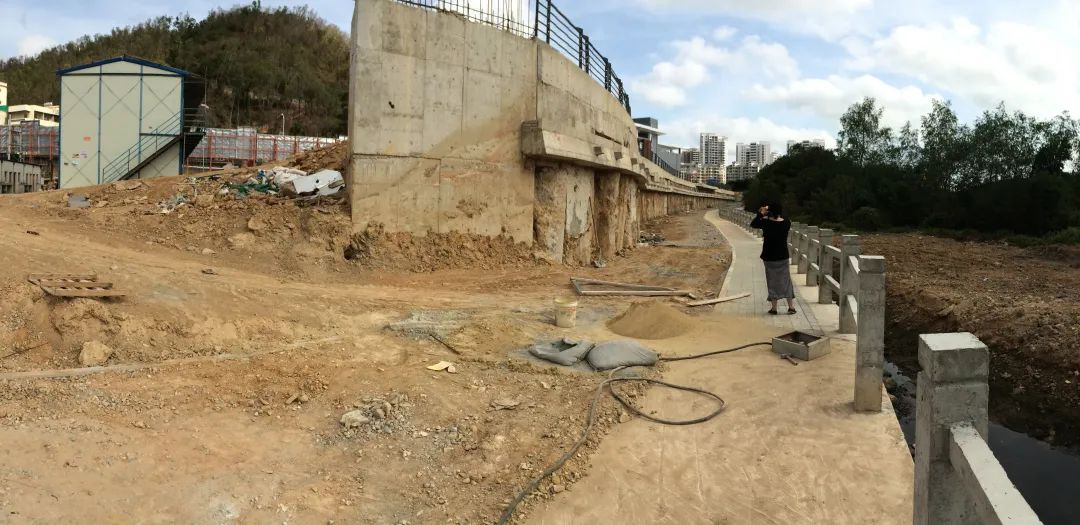
↑Before the ecological restoration
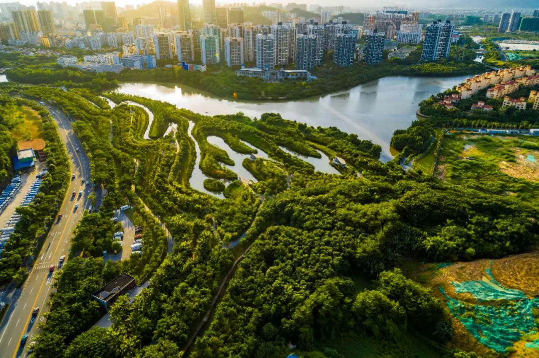
↑After the ecological restoration
10. The Shangrao Xinjiang Ecological Corridor
The Shangrao Xinjiang Ecological Corridor is based on ecological conservation and aims to restore and enhance ecological functions. It consists of seven major landscape zones: riverside wetland zone, inner river waterfront zone, urban countryside zone, urban balcony zone, landscape road zone, valley leisure zone, and lotus pond valley zone. Building upon the ecological foundation, a set of low-impact slow travel systems has been designed. This includes an elevated pedestrian boardwalk located above the 50-year flood level, connected to a panoramic bridge spanning the river; a pedestrian boardwalk in the urban balcony zone designed to withstand a 20-year flood event; and a network of walking trails in the intertidal wetland area to accommodate different recreational needs while addressing the risk of flooding. Ultimately, the corridor will become an urban park that prioritizes ecological conservation while offering diverse and distinctive experiences.
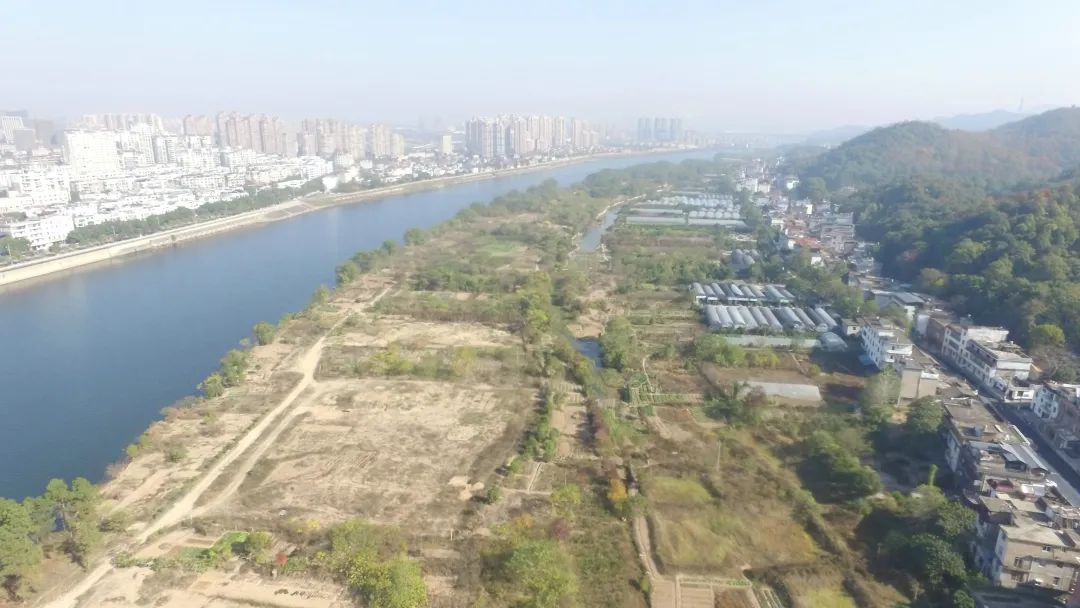
↑Before the ecological restoration
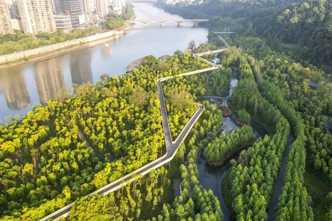
↑After the ecological restoration
Source:<https://mp.weixin.qq.com/s/BMFteIgpy6F2vuqT8IivLg>
Edited and Translated by Jia Mengyuan