Cao Xiangming (School of Human Settlements and Civil Engineering of Xi’an Jiaotong University)
Cai Juanjuan (The Administrative Committee of Xi’an Yanliang National Aviation Hi-Tech Industrial Base)
As COVID-19 has continued unabated since its outbreak in China, it’s become increasingly urgent for city planners to think hard about how to build healthy and safe cities in addition to reviewing any risks and issues pertaining to urban public health and safety. The primary transmission route of COVID-19 is through close person-to-person contact and through direct contact with respiratory droplets generated when an infected person coughs or sneezes, but airborne transmission is possible as well. So urban ventilation would play a key role in preventing and controlling respiratory diseases. This article is about building urban ventilation corridors with a few recommendations proposed.
Group-based urban structure can effectively stem the outbreak and spread of epidemics
In the last few years, with urbanization gaining greater momentum in China, urban development has been on the fast track across cities at all levels, but at the same time, calm winds have become more frequent in cities and haze severe in big cities due to declining urban air quality. Given most of the cases of COVID-19 were reported in densely populated capital cities or big cities in provinces except Hubei, planners should think about an urban space structure that would be conducive to ventilation. The reason is that once a respiratory disease occurs, a well-ventilated urban environment can minimize outdoor infections.
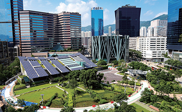
Greenbelts between groups are the lungs of a city
American architect Eliel Saarinen proposed the idea of organic decentralization as early as 1934. According to the concept, a city can be divided into areas used by different centralized points just like an organism, with each area forming a group and an interspace in between for “breathing”。 In the 1950s, while making urban plans for Chandigarh of India, Le Corbusier proposed that the greenbelts running through residential areas of a city, like the lungs, can bring prevailing or local winds into the city to clean the air and reduce summertime temperatures. Hence, when it comes to urban space expansion, a group- based urban structure divided by greenbelts can be built to provide better ventilation.
Many cities in China have problems with ventilation. For example, plain-based cities often display a pattern of excessive sprawling, where the central areas extend with no interruption, making them badly-ventilated; and valley-based cities usually have weaker prevailing winds as they’re surrounded by mountains, making it hard for pollutants to spread and for air to circulate. Given the weak ventilation in these cities, the group-based structure, if adopted, would help their land for construction fully exposed to natural environment to increase airflow and allow more winds to get inside the cities. At the same time, it’s necessary to regulate land development in urban-rural fringe to allow its cool winds to blow into cities.
Each group can serve as a control unit under special circumstances
As a space structure that integrates urban and rural areas, the group pattern is a breakaway from the conventional pattern that the circle dominated by economic activities extends outward or expands axially, and focuses on ecological, economic, and social coordination and harmony. Greenbelts between groups shall fit in with natural environment, such as naturally-formed water or hills. Such urban structure can better cushion any epidemics, as each group, as a control unit, can effectively prevent epidemic transmission in between.

Group-based urban spatial layout Photo: Cai Juanjuan
Each group has to be extended in the direction the wind blows
For an axially extended group in the upwind direction, its ventilation system shall function in concert with prevailing winds. For an axially extended group in the downwind direction, its internal spatial layout shall match local air circulation. Specifically, groups located downhill shall be put in line with the sphere of influence of valley wind and the time it blows, and groups close to riverbanks shall be put in line with the sphere of influence of river-land wind and the time it blows, to ensure good urban environment and air quality as well as ventilation of residential areas within each group. So in an epidemic outbreak, even if some residential buildings have to be quarantined in each residential area, better ventilation would reduce the risks that other residential units may face.

Diagram of river-land wind Reference: Liu Jiaping. Urban Environment Physics [M]. Beijing: China Architecture & Building Press, 2011.
The “water + road” ventilation corridor system in cities
Many big cities in China, such as Hong Kong, Beijing, Wuhan, and Changsha, have conducted research in the ventilation corridor system. A ventilation corridor is usually comprised of large swathes of water, major roads in parallel with dominant winds, concentrated urban greenbelts, squares, land not used for construction, and low-rise building complexes, which connect with one another. It contributes to healthy development of cities, in that it can effectively enhance urban air circulation and reduce summertime urban heat island effect and urban pollutant concentration.
On one hand, prevailing winds are usually weaker in inland cities. On the other, urban air pollution would become increasingly prominent as cities expand. As valley and river-land winds can greatly improve urban wind environment due to the thermodynamic circulation created by mountains and rivers, guiding valley and river-land winds to provide better ventilation in cities would be key to improving the wind
environment of valley-based cities. As for cities with higher calm wind frequency, their major open space consists of linear channelized riverways and road space. Hence, effective use of linear space would be an important part of building ventilation corridors in such cities.

Diagram of guiding wind in riverside areas Photo: Cai Juanjuan

Diagram of forest-source wind Reference: Ren Chao. Urban Ventilation Assessment and Wind Corridor Plan [M]. Beijing: China Architecture & Building Press, 2016.
Water-based urban ventilation corridor
Development of all cities is closely related to water. As major air passages which makes them unique edges of a city and as major ventilation corridors for a city, riverways shall be developed on two fronts. On one hand, the blue lines for riverways as a sphere of protection shall be clearly drawn, green buffers on both sides of riverways extended, and riverside buildings terraced to allow space for ventilation corridors. On the other, the water in the riverways, which has a prominent advantage as the ecological cold source of cities in their temperature inversion, can be designated as important compensatory space for urban wind environment.
The full contact of a city with its rivers would contribute to the system of its ventilation corridors. So embedded installations for inducing air have to be built in riverbank zones to avoid the closed wall-type riverside layout. It’s better to have a bell mouth layout for the buildings at the intersection between city roads and riverside roads, and buildings on both sides of an intersection shall be held back and terraced to create small space for open green space square, which would be conducive to urban landscaping and ventilation. The height and density of buildings in riverside zones shall be limited, to allow river-land wind to permeate concentrated construction areas of a city.
Urban road-based ventilation corridor
Urban road system provides the framework for urban development. When urban roads extend in the same direction prevailing winds blow, the roads can act not only as urban transport but as ventilation corridors, and the effectiveness of ventilation very much rests with the direction, width, and cross section of roads. For road-based ventilation corridors, widening motor vehicle lanes alone wouldn’t make good ventilation. But it can be done, while building ventilation corridors based on major roads, by putting greenbelts of a certain width or green space parks with a certain area on both sides of the streets that can potentially become ventilation corridors and integrating multiple urban functions to make ventilation corridors environmentally-friendly and recreational. For example, for Tangyan Road, the 100-meter-wide boulevard built along the relics of the Tang Dynasty city wall in the city of Xi’an, the height of the building complexes on both sides shall be reasonably controlled, roof and vertical greening can be adopted to increase green coverage and improve local climate, and strip-style windward building complexes can be replaced with tower buildings.
Scale effect of ventilation corridor
According to research, a Level1 ventilation corridor is usually comprised of such open space as rivers, lakes, and large belt-shaped parks running through the entire downtown of a city, which wouldn’t provide desired ventilation unless its width reaches 80 to 150 meters; and a Level-2 ventilation corridor is built usually based on trunk roads and open space,which has to be at least 50 meters or so wide before there is any ventilation. For example, Xi’an is transforming its 100-meter-wide road-based greenbelts to make slack winds stronger.
Expand urban green space to allow green-source wind to come into play
As a unique green underlying surface in all sorts of urban land for construction, urban green space can effectively influence and improve urban local microclimate, playing a key part in enhancing overall quality of urban environment. On one hand, plants absorb carbon dioxide and release oxygen through photosynthesis, and on the other, they absorb a great deal of heat from the environment through transpiration which reduces ambient temperatures and increases humidity. As stretches of green space are out of step with temperature rise and fall of surrounding buildings, local winds moving at the speed of 1m/s, i.e. forest-source winds, would appear, blowing from green space to concentrated building areas, which helps make comfortable local environments in big cities in the state of calm winds on hot summer days.
The spread of respiratory diseases is closely related to urban air quality and circulation. As the lungs of cities, ventilation corridors help improve urban air quality, accelerate air circulation, cut off outdoor transmission routes of infectious diseases, and make people enjoy a greater sense of security and happiness outdoors. In the face of COVID-19, every planner shall have deeper reflections on urban spatial development patterns going forward.
Copyright @ 2014 Urban Planning Society of China
Registration Number:05073892-1
