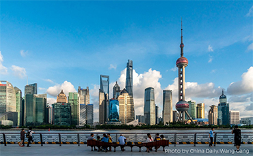


Lujiazui, the financial center in Shanghai, forms a core part of the integrated development demonstration area. [China Daily/Wang Gang]
The State Council has approved a national territorial spatial plan from 2021 to 2035 for the high-quality development of the eco-friendly and green integrated development demonstration zone in the Yangtze River Delta, which provides a basic basis for the planning, construction and spatial governance of the demonstration zone.
The plan has 8 chapters and 65 articles and contains 23 atlases and 58 near-term key projects. It mainly focuses on the development objectives, spatial strategy and bottom-line control requirements in the areas of farmland conservation, ecological environment, urban and rural layout, historical and cultural characteristics, public services and amenities.
1. Background.
The plan, guided by the Ministry of Natural Resources and jointly prepared by the governments of Shanghai municipality, Jiangsu province and Zhejiang province, was launched in July 2019 and approved in February 2023.
The plan is of great practical significance in promoting the implementation of the integrated development strategy of the Yangtze River Delta and the coordinated development of the region and the integrated development of urban and rural areas. Moreover, as the first cross-administrative territorial spatial plan approved by the State Council, the plan provides a reference for the preparation and implementation of regional territorial spatial plans in other regions and acts as a pilot for deepening the reform of "integration of various plans" and improving the system of the territorial spatial plan.
2. Development Objectives.
In terms of objective positioning, the plan is based on a global vision with international standards and Chinese characteristics. The development objective of the demonstration zone is to build an area where humans and nature live together in harmony, functional and scenic integration is achieved, the innovation chain and the industrial chain progress together, Jiangnan charm and the flavor of town resonate, and public services and amenities are shared. At the same time, around the overall objective and vision of "a world-class water town habitat civilization model", the plan specifies an index system consisting of 25 core indicators to ensure the realization of objectives, among which there are 8 binding indicators and 17 expected indicators.
3. Spatial Strategy.
With the reform requirements of the territorial spatial plan, "four principles" are highlighted as follows.
3.1 To adhere to ecological priority and green low-carbon development.
Strengthen ecological protection and protect nature and the environment as we do our own lives. Implement the strictest farmland protection system and ensure the farmland will not be reduced. Transform the traditional development model led by investment and factor inputs as well as the expansion of land, carry out "negative growth" of buildable land, and encourage the transformation of the development mode through the change of resource utilization.
3.2 To adhere to innovation-driven and high-quality development.
Promote the new economy with beautiful scenery, turn ecological merits into development advantages, and encourage the deep integration of the innovation chain, industry chain, capital chain, and talent chain to drive the development of strategic emerging industry clusters. Strengthen the protection and revitalization of historical and cultural heritage, brand the Jiangnan Culture, and speed up the implementation of major cultural and creative industry projects. Further deepen reforms to create a replicable leading example that benchmark the highest standards and best performance.
3.3. To adhere to multi-center, networked, and integrated spatial development.
Optimize the territorial spatial development layout, root out centralized layout, large-scale and high-intensity development, and promote the collaborative development of city and town clusters. Strengthen the support of a comprehensive transport network and compound hubs to improve the linking efficiency of the transport network. Conserve the spatial fabric of Jiangnan water towns, integrate with modern functions, and build water towns with harmonious coexistence of "river, lake, farmland, town, and village".
3.4 To adhere to cross-border coordination and integrated development.
Break administrative barriers and institutional fences, clarify common planning control bottom line and standards, strengthen regional ecological environment protection and governance, promote infrastructure interconnection, encourage the sharing of public service facilities and resources, and establish a new mechanism for integrated regional development with unified standards and concepts, shared resources and information, integrated governance and law enforcement, and effectively guaranteed consultation.
Source: <http://english.www.gov.cn/policies/latestreleases/202302/21/content_WS63f459bbc6d0a757729e6ff1.html>
<https://www.shanghai.gov.cn/nw9822/20230222/f9e6f96bc6c948b3a6f08c607e7f3cc9.html>
Edited and translated by GUO Xinxin
Copyright @ 2014 Urban Planning Society of China
Registration Number:05073892-1
